Where to find us
Click here for your nearest centre Contact Us
Where to find us
Click here for your nearest centre We have 3 modern dental practices throughout Sussex covering a wide catchment area and currently have over 20,000 active patients. We pride ourselves on providing an excellent level of service for you and your family, at an affordable price using the latest techniques and materials.
Please note we operate a strict 48 hour notice cancellation policy. Any cancellations made without the required 48 hours notice may be charged for. Please speak to a receptionist for more details.
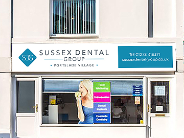
Welcome to SDG Portslade Village (formerly The Old Village Dental Centre), providing quality dental care to the residents of Brighton, Hove, Portslade, Shoreham and the surrounding areas. SDG Portslade Village has been established at its current site for over 30 years. It joined the Sussex Dental Group in 2007. Every year our practice provides dental care…
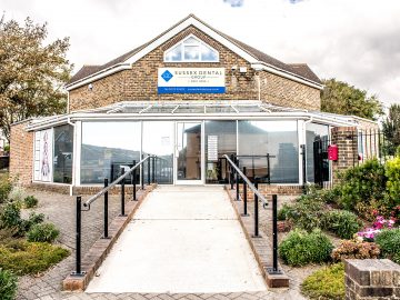
Welcome to SDG West Hove (formerly Portslade Dental Centre), providing dental care to residents of Brighton, Hove, Portslade, Shoreham and the surrounding areas. SDG West Hove was established in October 2002 and is part of the Sussex Dental Group. Every year our practice provides dental care to over 10,000 registered patients. We have seven…
Please note: We have moved!! SDG – Crawley are pleased to confirm we are now operating from our new premises on the corner of Coachmans Drive and Broadfield Place, RH11 9YZ. We look forward to welcoming you to the new premises. Welcome to SDG Crawley (formerly Broadfield Dental Centre), providing quality dental care to…